OAS

What Unsolved Mysteries Lie Beneath Stonehenge?

Click on the image above to download the lesson.

Click on the image above to download the lesson.

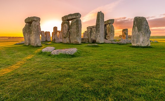
Description: Students will learn that more than fifteen previously unknown monuments: henges, barrows (burial mounds), ditches, and pits have recently been discovered buried beneath the ground in the area around Stonehenge.

 Grade level(s): Middle                     Standards: OAS, GFL, CC       Produced By: Glenda Sullivan

The Great Wall of China

Click on the image above to download the lesson.

Click on the image above to download the lesson.

Description: Students will discover when the Great Wall of China was first built; when it was built as it exists today; who the laborers were who built the Wall; what materials were used to build it; why the Wall was built; problems encountered in maintaining the Wall even today; and new evidence as to the entire length of the Great Wall.

 Grade level(s): Middle                     Standards: OAS, GFL, CC       Produced By: Glenda Sullivan

Oil, Religion and the Global Landscape

Click on the image above to download the lesson.

Click on the image above to download the lesson.

Description: The Middle East produces about a third of the world’s oil which makes the entire world reliant on that oil and natural gas. The goal of this lesson is to use map skills to gain an understanding of the effects of abundant oil supplies in the Middle East. Using maps, students will analyze data from a geographic perspective. They will increase their understanding of conflict and cooperation among specific groups over oil and religious differences. They will also identify multinational peace-keeping efforts to stabilize relationships in the Middle East.

 Grade level(s): Middle                   Standards: OAS, GFL             Produced By: Teresa Potter

Map Reading 101

Click on the image above to download the lesson.

Click on the image above to download the lesson.

Description:Using the scale from the map key, students will find the approximate air distance between cities on different maps. This skill will enable them to find any distance on a map or globe.

 Grade level(s): Middle                     Standards: OAS, GFL             Produced By: Susan Smith

The Impact of Economic Development on Russia's Arctic Regions: Opportunities and Challenges

Click on the image above to download the lesson.

Click on the image above to download the lesson.

Description: Through exploration and analysis of primary and secondary sources of visual information, and printed and digital texts, students will discover and be able to summarize why the changing Arctic has become an important economic region for development, the opportunities and challenges that face Russia, as well as her neighboring countries in the Arctic, and how what happens in the Russian Arctic affects the rest of the global community.

 Grade level(s): Middle                     Standards: OAS, GFL             Produced By: Lynn Tilley

Using Absolute Location to Improve Your Mental Mapping

Click on the image above to download the lesson.

Click on the image above to download the lesson.

Description: Students will understand how latitude and longitude can assist them in finding specific places. They will be able to apply knowledge of location when organizing information about regions and the people who live in them. They will determine what natural resources are available for the people who live in the regions around the rivers, deserts, seas, mountains, and peninsulas being studied.

 Grade level(s): Middle                     Standards: OAS, GFL             Produced By: Susan Smith

Absolute Location: Knowing Exactly Where You Are!

Click on the image above to download the lesson.

Click on the image above to download the lesson.

Description: Using longitude and latitude, students will find specific locations on maps and globes. Students will be able to use absolute location to find any specific place on any maps and globes (they include a grid system). When given a list of cities or geographically important locations in North and South America, students will be able to apply knowledge of absolute location to pinpoint their locations.

 Grade level(s): Middle                     Standards: OAS, GFL             Produced By: Susan Smith

Straits of Magellan

Click on the image above to download the lesson.

Click on the image above to download the lesson.

Description: Students will locate the Straits of Magellan, discover its importance as a sailing route connecting the Atlantic and Pacific Oceans until the Panama Canal was completed in 1914, and will learn what its navigation purposes are today. 

 Grade level(s): Middle                     Standards: OAS, GFL             Produced By: Glenda Sullivan

The Impact of Monsoons and Cyclones in South Asia

Click on the image above to download the lesson.

Click on the image above to download the lesson.

Description: Monsoons, together with cyclones, have a great impact on the agriculture and lives of people in this region, especially in India and Pakistan. The purpose of this lesson is for students to understand the interactions and influences of monsoons and cyclones on the people of South Asia, and how physical systems, being both life-giving and destructive, can produce resilience in people of the regional areas.

 Grade level(s): Middle                     Standards: OAS, GFL             Produced By: Lynn Tilley

North Sea Petroleum Reserves: The Value to Developed Nations' Economies

Click on the image above to download the lesson.

Click on the image above to download the lesson.

Description: The purpose of this lesson is for students to gain an understanding of the value of the North Sea petroleum reserves to the economies of Europe, both those nations that produce the energy, and the ones that consume the oil and natural gas found there. Through observing and analyzing maps, graphs, and charts of data and other information, students will integrate visual information, draw conclusions, and make predictions and inferences, to gain an understanding of the economic interconnectedness of these countries.

 Grade level(s): Middle                     Standards: OAS, GFL             Produced By: Lynn Tilley

Major Cities Spanning Europe and Asia

Click on the image above to download the lesson.

Click on the image above to download the lesson.

Description: Students will learn the location of several major European and Asian cities as well as discovering important physical and cultural characteristics of these various cities.

 Grade level(s): Middle                     Standards: OAS, GFL, CC       Produced By: Glenda Sullivan

American Progress

Click on the image above to download the lesson.

Click on the image above to download the lesson.

Description: Students will understand Manifest Destiny and the idea of expansionism during the 1800s. They will analyze John Gast’s painting, “American Progress” and use the information/knowledge gained to write an argumentative essay.

 Grade level(s): Middle and High School   Standards: OAS, GFL                 Produced By: Teresa Potter

Unsolved Mysteries: What Happened to the Orangutan?

Click on the image above to download the lesson.

Click on the image above to download the lesson.

Description: The goal of this lesson is for students to be able to use reading and investigation skills to make inferences about what has happened to the orangutan. By identifying the plight of the orangutan and the contemporary issues facing Indonesia, students will discover how human activities have modified the environment, resulting in deforestation in Indonesia.

 Grade level(s): Middle                     Standards: OAS, GFL             Produced By: Teresa Potter

Transportation in the News

Click on the image above to download the lesson.

Click on the image above to download the lesson.

Description: Students see transportation all around them but do not know geographic and historic background about the development of types of transportation. Students will gain geographic and historic perspectives about transportation as they explore American ingenuity that overcame geographic and economic issues in history.

 Grade level(s): Middle and High School   Standards: OAS, GFL               Produced By: Bill Amburn

The Push-Pull Factor Getting to the Bottom of It

Click on the photo above to download the lesson.

Click on the photo above to download the lesson.

Description: The goal of this lesson is for students to identify the main groups of immigrants to the United States from 1820-1920, and the push-pull factors associated with these immigrant groups.

 Grade level(s): Middle and High School   Standards: OAS, GFL               Produced By: Teresa Potter

Flipping Through the Western Hemisphere

Click on the image above to download the lesson.

Click on the image above to download the lesson.

Description: Students will gather information on a selected state, province, or country to better understand the relationship of the countries in the Western Hemisphere.

 Grade level(s): Middle                       Standards: OAS, GFL             Produced By: Bob Harrelson

The Aral Sea: An Unnatural Disaster

Click on the image above to download the lesson.

Click on the image above to download the lesson.

Description: Students will understand that water diverted for irrigation or other purposes can have a direct impact on the environment, including environments that cross international boundaries.

 Grade level(s): Middle                         Standards: OAS, GFL, CC       Produced By: Janet Hall